May 2019 itinerary link continue from Day 3

There are so many little(or not so little) historic towns one can visit easily(reachable by 1-2 hour train ride) from Porto, and I considered Braga(population: 136,800) and Viana do Castelo(population: 88,000) but picked Guimaraes(population: 47,500) mainly because Guimaraes is known as the birth place of Portugal. This is so because it is believed that Portugal’s first King, Afonso Henriques, was born there in 1106(or a little after), and also due to the fact that major political and military events that would lead to the independence(from Spain) and the birth of a new nation of Portugal took place in Guimarães area in 1128.


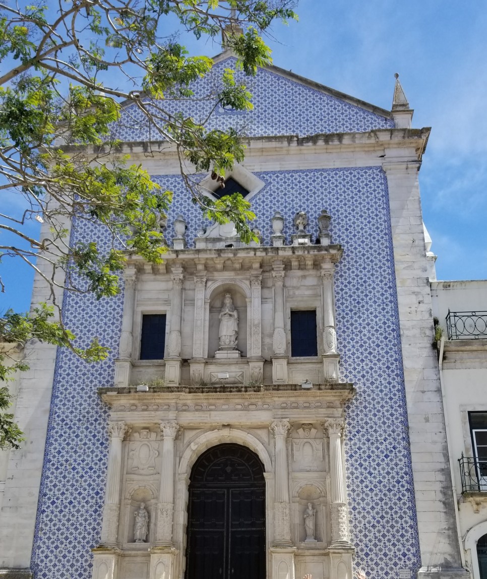
The train ride(7 euros R/T) from Sao Bento station in Porto to Guimaraes took a little over an hour or so. We were there on a Monday, and the city seemed very quiet when we got off the train and walked into town. It was an easy 10-15 minute walk to the first sign of this UNESCO Heritage Site, Santos Passos Church.(#5 on the map & the train station is south from there) This beautiful church(full name: Igreja de Nossa Senhora da Consolacao e Santos Passos) was almost empty when we visited around 10 AM, but we noticed some tour buses were starting to arrive.

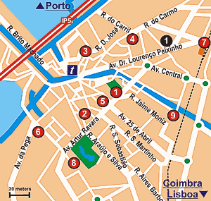
From here to the old town area is straight up the hill but not too stiff. Finding Largo da Oliveira plaza was not hard, and we started exploring the center of town from here just by walking around sticking our head in here and there.
After a half an hour or so, we decided to find the Castle, but it was not as obvious which direction we had to go while we were in the middle of meandering little streets. We noticed a table full of gentlemen sitting in front of a cafe having their morning coffee, and we asked them. A distinguished looking gentleman from that group gestured us to follow him, and we did. After a few minutes, we came to a point where some streets came together. He pointed to one street and gestured us to take that street. We tried to do so, but it was still confusing to figure out exactly where we had to go. He was watching us from behind, then, once again, he took charge and led us. He seemed to know everyone in town. (We joked that he might have been the mayor of this town at some point in his life.) After 5 minutes or so of him leading us slowly up the hill, we could tell the Castle was straight up from there. We thanked him profusely and marched on.

First came Dukes of Braganza Palace(Paço dos Duques de Bragança) which was built around 1420 and is now a part of national museum. We bought the 6 euros combined ticket for this Palace and the Castle next door. Not extravagant but lots of intricate details.

Guimaraes Castle have been constructed in the 10th century to defend the city from the Muslims. The first king, Afonso Henriques, lived in this Castle, and started conquering Portugal from the Muslims from this place. Thus, this castle is considered the greatest historic symbol of Portugal.
Sufficiently hungry, we slowly descended the hill and turned a bit west of the center area to get to our lunch spot, Cantinho dos Sabores. We got confused about the lunch menu mainly because it was so cheap. Soup, salad, entree, dessert, drinks(juice, soda, beer or wine): you could have all of that for, like, 6 euros? It got cheaper each time you skipped a course. There was a constant stream of people going in and out or waiting for a seat, but the servers kindly accommodated us(with smile) asking lots of questions. Unfortunately, they had run out of more popular items, but everything we had was good.
We didn’t feel like staying indoors since the weather was so pleasant. So we skipped the museums and walked around a bit. Some of us got ambitious and said we should do the cable car that we saw earlier over our heads as we walked up the hill from Santos Pasoss church, our first stop.
Well, it was not as easy to find it, though. By now, we were all used to approaching a local person and asking a question by gesturing. Soon we figured out the magic word, “teleferico” — cable car in Portuguese. After about 4-5 times of shouting “teleferico” to a smiling stranger, we came to what looked like a big apartment and shopping complex. Before heading in, we asked a truck driver, “teleferico?” He motioned us to hop on his truck so he could drive us there! We politely declined and walked on, smiling.

The cable car ride was worth 6-7 euros we paid for the round trip. There was a cute church up on top of Penha Mountain that the cable car took us to, and the unobstructed view of the surrounding area of Guimaraes was breathtaking.
On the way home from Sao Bento station, we remembered wonderful smell that came out of this chicken restaurant we passed by the other day that had a line out the door. We picked up some roasted chicken, potatoes, and salad from that restaurant and ate at home.

After dinner, we went over to Ponte Luis I bridge to witness the evening view of Porto and Douro. No matter how many times you’ve seen it in person or photos, you still can’t help but be awestruck by the sheer beauty of the scene. We had to toast the night, thus, we went to the roof top bar, Auru, overlooking Ave. dos Alidados. They served delicious olives which went perfectly with our cocktails.
Day 1: Porto
Day 2: Douro Valley
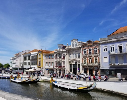
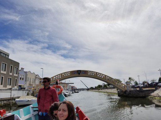
Day 3: Aveiro
Day 4: Guimaraes
Day 5: Porto
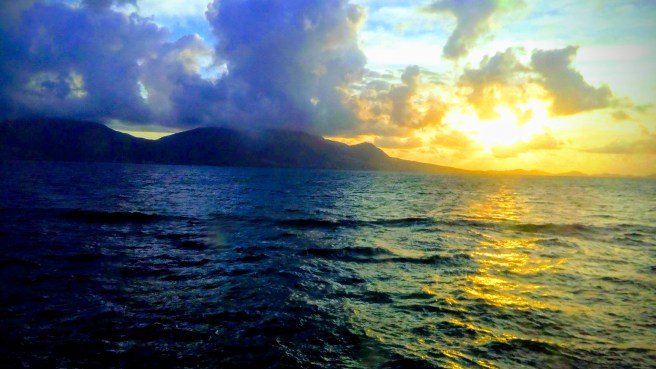 St. Kitts
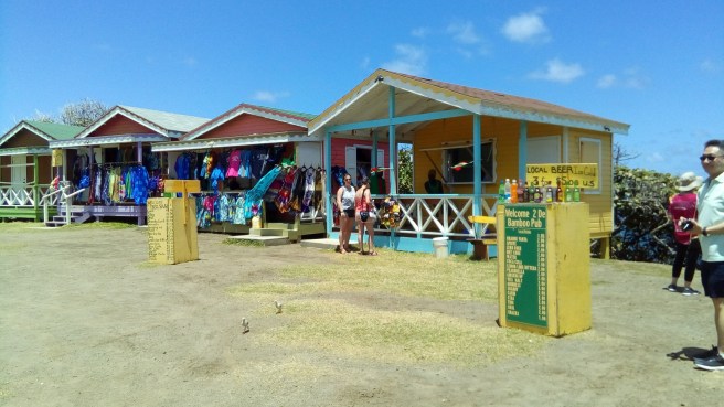
 The cruise terminal here was typical of most others in Caribbean: step down the gangway of the ship, and you are met by local bands or singers/dancers. Then comes a shopping area that is dominated by jewelry shops(mostly international chain stores). You will be approached by local tour operators selling $25 per person tours.


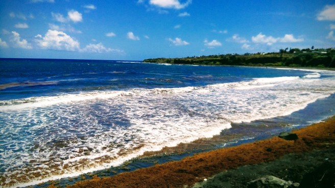
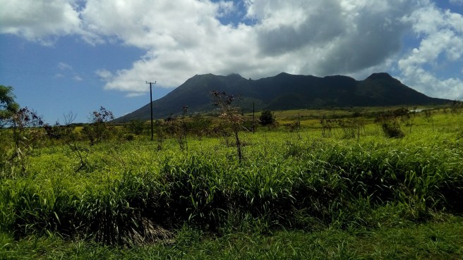 A black sand beach that resulted from the last eruption of Mt. Liamuiga was stunning. Our guide wanted to tell us about every single town on the ring road, but, frankly, there was not a whole lot of story in most of them. After all, it’s just a little island with 50,000 people!